HELP SHARING
Best Practices are examples of outstanding contributions to improving the green economies and sustainable development in the Biosphere Reserves.
BiosphereSmart (BS) "Tour" provides a user global view about BS vast options, grouped in four main areas:
Through this option: ![]() , BS switches to "Multilevel Menu", offering all the existing map options for the advanced user.
, BS switches to "Multilevel Menu", offering all the existing map options for the advanced user.
The term global change defines a set of environmental changes affected by human activity, with special reference to changes in the processes that determine the functioning of the Earth system. Climate change refers to the effect of human activity on the global climate system, which still affects result of global change, in turn, other fundamental processes of the Earth system performance.
The Earth system consists of the land, oceans, atmosphere, poles, life, the planet's natural cycles and deep Earth processes. These parts interact and influence one another. Global change refers to planetary-scale changes in the Earth system. Since the Earth system now includes also human society, global change also refers to large-scale changes in society. Biosphere Smart offers the possibility to visualize the Biosphere Reserves as laboratories of sustainability in real time, within the context of a continuously changing world.
UNESCO biosphere reserves are ideal places to test, evaluate and implement comprehensive climate change policies. Warming of the climate system is unequivocal, as is now evident from observations of increases in global average air and ocean temperatures, widespread melting of snow and ice and rising global average sea level. Climate change is increasingly recognized as the driver of biodiversity change with the most rapid increase in impacts and related cascading effects on human livelihoods. On the other hand, loss and degradation of biodiversity is an important driver of climate change.
BiosphereSMART is a platform addressed to learn and maintain the climate change knowledge base through science, assessment, monitoring and early warning.
Biosphere reserves are sites established by countries and recognized by the Man and the Biosphere Programme (MAB) of UNESCO to promote sustainable development based on the efforts of the local communities and scientific knowledge. Composed of 621 biosphere reserves in 117 countries, including 12 transboundary sites, the WNBR of the MAB Programme promotes North-South and South-South collaboration and represents a unique tool for international co-operation through sharing knowledge, exchanging experiences, building capacity and promoting best practices.
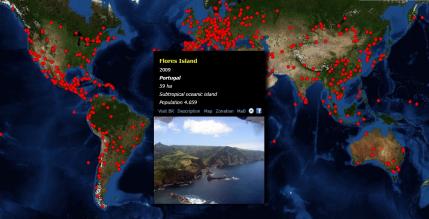
Composed of 621 biosphere reserves in 117 countries, including 12 transboundary sites, the WNBR of the MAB Programme promotes North-South and South-South collaboration and represents a unique tool for international co-operation through sharing knowledge, exchanging experiences, building capacity and promoting best practices.
This section can be viewed in GIS support, all biosphere reserves worldwide, and their limits. It can access detailed information on these areas of great interest to man.

This map shows the zoning of Biosphere Reserves:
• Buffer zone: it is understood by those spaces can only be made where activities that contribute to the multiple objectives of the Reserve.
• Transition zone: the farthest part from the core area, where the work of the Biosphere Reserve is applied discreetly to the needs of local communities in the region.
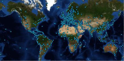
The World Heritage List includes 981 properties forming part of the cultural and natural heritage which the World Heritage Committee considers as having outstanding universal value. These include 759 cultural, 193 natural and 29 mixed properties in 160 States Parties. As of September 2012, 190 States Parties have ratified the World Heritage Convention.
A Smart Biosphere Reserve makes maximum use of new information technologies to help build a covenant for a sustainable future and a transition to green societies based on knowledge and life-quality improvement in a low CO2 emissions scenario.
The BiosphereSmart platform has been designed as a tool for improving governance in the BRs. Community members and local managers become the principal beneficiaries of the information system.
From this section you can access the interactive map of the World Network of Biosphere Reserves. By accessing this layer, you will find the most relevant information on each reserve,including its boundaries, zonation, website, and videos. You can also access the Smart BRs that have been joining the platform.
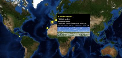
Tourism should contribute to sustainable development and be integrated with the natural, cultural and human environment. Sustainable tourism must ensure an acceptable evolution as regards its influence on natural resources, biodiversity and the capacity for assimilation of any impacts produced.
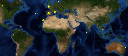
Biodiversity or biological diversity is the variety of life. The concept of biodiversity includes species diversity, genetic diversity and the diversity of ecosystems or habitats. The services that biodiversity provides us are the basis of human well-being. The interactive map shows the submitted initiatives carried out in BRs.
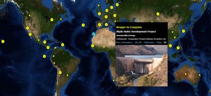
Promoting the commitment to increasing energy efficiency and use of renewable energy sources on UNESCO sites. The interactive map shows the projects and sustainable energy initiatives in biosphere reserves.
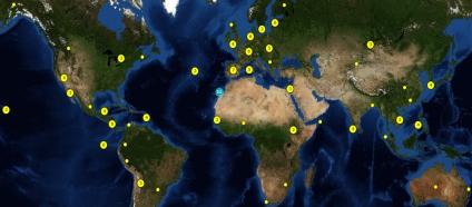
Renewable Energy Futures for UNESCO Sites. Models of excellence to foster the integration of renewable energy for global sustainability. The RENFORUS Initiative promotes the use of UNESCO Biosphere Reserves as field observatories on the sustainable energy.
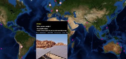
Renewable Energy Futures for UNESCO Sites. Models of excellence to foster the integration of renewable energy for global sustainability. The RENFORUS Initiative promotes the use of World Heritage Sited as field observatories on the sustainable energy.
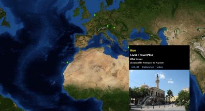
Fuerteventura Biosphere Reserve. The EC STARTER project aims to promote energy efficient and sustainable mobility policies and practices through the cooperation of all local interested parties. Objective: Make more efficient use of energy and contribute to reducing CO2 emissions.
The environment is the place in which we develop our life. We've all heard of the serious deterioration Earth is experiencing and also suffer the consequences: pollution, water shortages, loss of quality of life.Given this challenging environment, we must take responsibility and know the possibilities we have to improve and protect it.

BiosphereSmart allows us, through this section, access to the relevant information, such as initiatives undertaken, best practices classified by type, developed projects etc... and manay other tools, to strengthening the potential role of biosphere reserves as learning platforms for sustainable development.

WELCOME TO THE
BIOSPHERE SMART PORTAL
A global observatory created to shared ideas, knowledge,best-practices, and experiences among Biosphere Reserves on issues related to climate change, green economies, and sustainable development.

Best Practices are examples of outstanding contributions to improving the green economies and sustainable development in the Biosphere Reserves.

Biosphere Smart is a global observatory created to share ideas, knowledge, best-practices, and experiences among Biosphere Reserves on issues related to climate change, green economies, and sustainable development.
The Biosphere Smart Initiative was approved during the 24th Session of the International Co-ordinating Council (ICC) of the Man and the Biosphere (MaB) Programme (2012), which highlighted the "need of the MaB Programme and its networks to be a substantial tool for the implementation of the Rio+20 follow up and for this purpose on the need for the improvement of the communication by using tools like Biosphere SMART on green economies and by using biosphere reserves as study sites for all UNESCO Programmes".
Biosphere Smart Initiative is an open platform of cooperation supported, among others, by the Observatory of Sustainability and Global Change (OSCG), UNESCO Centre of the Canary Islands, Fuerteventura BR, Santana BR, Canary Islands Government-ITC, Principe Island Regional Government, El Hierro BR, Spanish MAB National Committee, Purtuguese MaB National Committee, University of La Laguna, University of Murcia, , OSE (Observatory on Sustainability in Spain), REN21 (global renewable energy policy multi-stakeholder network), Plan Avanza, and operated by TEYDE.
The Biosphere Smart Initiative is based on the idea to maximise the use of new information technologies to build a covenant for a sustainable future and a transition to green societies based on knowledge.
Citizens become both beneficiaries and key actors of the information and participation tools of the Initiative. They can also be sensors able to provide information about their spatial experiences, improving their capacity of participation and co-design.
Biosphere Smart provides this web-based platform linked to UNESCO-MaB for Biosphere Reserves and similar territories, with the aim of:

Click on each image and visit the website of the partnership and find out all information about the Biospheresmart tool.
Contains different elements in which, you can find out a summary explanation of the functionality and scope of the project Biospheresmart. Move your mouse over each tab and check out the information of each tab.
Press button ![]() to change the Mega Menu to Multilevel Menu View and viceversa.
to change the Mega Menu to Multilevel Menu View and viceversa.
To access different viewer options related to map tasks and GIS tools. Show & hide dialogs and map complementary elements.
By clicking on the map, the identify feature retrieves current layer information related to clicked position. The left slider provides the hability to change the default map zoom level.
These panels shown information related to the Biospheresmart platform, in which, you can find out objectives and the scope of the platform, information associated with partners, a brief description about the nature of the platform as well as different tools and links to related sites.
To access different viewer options related to map tasks and GIS tools. Show & hide dialogs and map complementary elements.
The base maps gallery dialog provides functionallity to switch base tiled map layer. The actual base map is the "Imagery Tiled Service" and you can change by clicking the base map image.
This dialog can be hidden by clicking the button located in Toolbar options.
The legend dialog contains information related to map displayed layers. You can find out a description of selected layers, encoded legends by colors related to the information shown on the map and different links to other interesting websites.
This dialog can be hidden by clicking the button located in Toolbar options.

